Wednesday, June 27, 2012

Mount Yale

Summit Ridge
I got a personal message (PM) on 14ers.com from Jeff wanting to get out on a climb on Tuesday.  Originally he wanted to head over to the Elk Range by Aspen and climb Castle Peak.  The weather outlook was less than satisfactory so we switched plans and decided on Mount Yale in the Sawatch Range.  Yale is part of the Colligate Peak Wilderness and is quickly becoming my favorite area in Colorado.

The plan was for Jeff and me to meet up hwy 285 near Aspen Park and commute together from there.  I was on time at 5am, but Jeff was 30 minutes late.  Not a good first impression, but I went with it.  By the time we drove over to the Denny Creek TH it was 7:30am, which was already a half hour past our intended start time.  The weather forecast didn’t look too bad; 20% chance of thunderstorms in the afternoon.  But, I have found out in Colorado if there is any chance of storms in the forecast, then they will happen.  So, this late start was unsettling since I know I hike at 1,000 vertical feet per hour on the lower sections then 700 ft per hour on the uppers.  Meaning, we wouldn’t have time to dilly dally around since a storm would most likely interrupt our climb.

After Jeff got set we were finally on the trail by 8am, an hour behind schedule now.  The first section of the trail appears to be a old Jeep Trail of sorts for the first half mile before narrowing a bit to resemble a bit more of a actual hiking trail.  After an initial gain the trail mellows out for quite a ways till taking the turn on to the Mount Yale Trail.  Overall the trail is very good, nicely cut and has lots of rock staircases.  The first two hours we were right on my pace at 1K feet per hour, but I knew it wouldn’t be long till I started slowing up.  We were still in tree line, which seemed to last forever.  I think we finally cleared the trees somewhere between 11,500ft and 12,000ft.  After we gained our first 2,500ft I told Jeff to take off and not wait for me.  I warned him I was slow so I didn’t want to hold him back.

Once I was out of the trees I had my first view of Yale.  I didn’t like not being able to see the goal for near 3hrs of hard work.  There were many people high on the trail; at least 20-30 which has been turning into the norm of Colorado 14ers even during the week.  I just slowly crept up the mountain, about as fast as a tortoise.  I felt so tired I just wanted to lie down and take a nap.  This seemed difficult for me; my mind was playing mental games.  You start to think; if I go this slow will I have time to make the summit?  Or, do I even have it in me today?  The mental aspects of climbing mountains are always the toughest to overcome.  As long as weather holds and it won’t be dark on the way down my stubbornness pushes me on.  I just say to myself: You don’t really want to do this approach again do you?  And the answer is always NO.  So slowly, but surely one foot in front of the other I kept making my way up the mountain.

Marmont and Mount Princeton
Looking back now it wasn’t really hard, since there was a trail up to the ridge, but it seemed steep winding up the switchbacks.  Have you ever seen The Lord Of The Rings trilogy, where they are in a camp up this steep switchbacked road?  Well, that is exactly what this reminded me of.  I think I may have slowed down to 500ft an hour by now, which is really, really slow.  After the trudge up the winding staircase I was finally on the summit ridge.  The summit loomed so close as did the clouds.  I had been monitoring them closely on my slow hike up and didn’t see any real threat heading to Yale.  Now the Elk’s and Mount Princeton were places I wouldn’t want to be, so looks like my good karma is paying off.

From the ridge to the summit is where to route goes from Class 1 trail to Class 2 rock.  I love Class 2 and Class 3 rock; it makes you feel like you are actually climbing instead of trudging up a trail.  And for some reason I move faster on it that a trail even at 14,000ft.  I’m guessing that is because the summit is so close and you want to get there as quick as you can.  At the start of the rock section there were a few cairns to navigate by, but soon I lost them and just made my own way.  It didn’t take long, only 20 minutes from the start of the rock to the summit.  When I arrived Jeff was up there waiting for me.  He must have been there and hour, so at least it wasn’t too cold and windy for him.

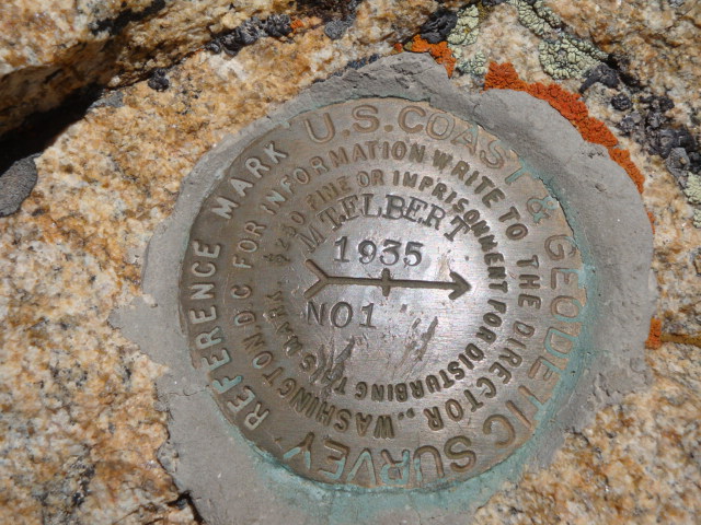
I couldn’t find a benchmark so I found a nice recliner rock to sit and have my lunch and my summit beer.  It was so nice to sit and relax.  In the time we were up there about 6 other people summited.  A group of 4 from Frisco basically tagged the top took a picture and left.  I’m guessing they were afraid of the weather.  Jeff was too as with another climber Michael we met that was from St. Louis had a fear of the clouds.  They headed down just as Denny another from Missouri (different group) made it to the summit.  I was amazed to see Denny up there in a river sandal and it just made my feet hurt thinking of his trip down.  I finished my beer and started heading down.

Summit Beer
I like to think that I have a good sense of route finding.  In all the years of climbing you learn to always descend the same way you ascend, because you don’t really know what is behind door number 2.  As I was following the route down I could see Jeff and Michael were way off route, about 100-200ft off the main ridge.  I tried yelling: you’re off route.  Finally they saw me up on the ridge and I tried to signal for an upward traverse of the rock.  I kept making my way across and made sure they were still making their way.  After I gained the main trail on the ridge I saw they had re-ascended to the proper route and found their way out of harm.  They said they got into some Class 3 territory, which I don’t doubt.  One of the most important things while climbing is to stay on route and always make mental notes during your ascent, because you will need to find familiarities on your descent.  If something looks way off on the descent calm yourself, use your brain and a way out will come to you.  I have always learned if it looks hard, such as re-ascending something, that is most likely the way to go at least you know what is up when you may not know what is down.

I was glad to see them back safely on the trail, but it wasn’t over.  We knew Denny was still up there and I didn’t want to leave till we knew he was back on the main trail.  As Jeff and Mike did, Denny took the wrong way getting too far off the main ridge.  We could tell he didn’t know what to do when he threw his arms up in the air.  I went back up to try and help him navigate down while the others watched from below.  Denny was able to find a way through the rocks in his sandals.  When I reached him he took off his tevas and shook out the rocks.  I asked him if he needed tape or anything, but like he said he’s a stubborn Missourian and just put his shoes back on and continued. 

Storm-a-brewing
The weather was starting to get really dark over Princeton so I thought it would be best that we all descend together.  We were still 2,000ft above tree line so we had a good hike ahead of us.  We just patiently followed Denny’s pace till we were off of the switchbacks.  He slipped one or twice because river shoes really have no place on a mountain.  We were kind of shocked to see four people on their way up.  We said hello to the first guy and got off the trail to let him by and didn’t get so much as a hi or thank you.  We guessed he didn’t speak English or he was just a grump…probably both.  Next we passed another guy doing a business deal on his cell phone.  Really?  He passed us running down the mountain 20 minutes later when he finally looked up at the clouds.

Then we heard the grumbles of the gods.  Thunder…ahh shit.  But I could deal with that, it’s when the lighting bolts came down we were all like shit, fuck…run.  I asked Denny if he wanted us to wait for him at the tree line, he said no but appreciated our helping him down.  We took off as fast as three could descend, running at times then navigating through rocks when needed.  Michael was behind me and said: Did you see that flash?  No, I said.  How far?  I’m not sure.  One ridge line or two.  In-between.  Great…run.

A lot this section was rather tricky, but soon we were in the trees.  My favorite was when Michael says if you hear me yell or moan don’t worry about it.  He says from yoga they tell you to do that to let the pain out.  If that’s the case I would have been screaming like a school girl, my knees hurt like hell and my toes were on fire.  Nothing like a 270 pounder running down a 14er in big old hiking boots.  It just wasn’t right.  When I got home I found I lost another toenail…my poor feet.

Once we were in the trees the trail started heading to the west, which was good since it was away from the black cloud of death.  I was pretty sure the clouds were making their way around Yale and would avoid us, but it’s always better to be safe than sorry.  We had a snack, got passed by two others that turned back on the mountain then we were off.  The trail seemed nice in the woods but the temp was heating up.  At one point the others thought it was going to rain on us so they put on some rain gear.  Not me, in this sauna you will get wetter from your sweat that the natural beauty of rain.  They soon found my point and took off their sweat suits.  I thought the hail was actually refreshing.  Maybe give me a bit of a shower for the way home?  Can’t hurt, can it.

I found my bottle of water I cached on the way up.  I see no reason in carrying extra weight that you know you will only need it on the way down.  And good thing, both Jeff and Michael needed extra water so I was more than willing to give them my extra weight.  Years ago while climbing a mountain in Idaho I ran out of water with a few miles left to the car.  Ever since then I carry extra, it may slow me down but I’m willing to deal with the extra weight. 

Now it was just a trudge down the trail.  I was down to one trekking pole since I broke the tip off of my other one on the ascent.  Now it was more of a cane than a trekking pole.  It’s hard to describe the pain in my knees without wanting to cry.  Have you ever felt a little twist and all the tendons would snap and your leg would just sit there in two?  Well I have, and on almost every climb.  My body was not made for punishment, but I still do it.  Needless to say, it was a slow walk down the trail.  The conversations we all had were a nice way to get my mind off all the aches, and soon we could hear traffic and we knew it wasn’t far.

It was another tough climb, maybe the hardest for me yet.  I guess maybe next time I wont stay up watching sports and drinking beer the night before.  But, I probably still will.  Somehow I always fight through it and make a great day of each trip.  I had an awesome time meeting Michael from St. Louis and we all shared some great stories on the way down.  Congrats to Micahel for making it up and down his first 14er!  Jeff is a quick hiker, just needs to tune up his navigations skills and he will be a great climber.  It was nice that we could all meet up for a slow descent after clearing the danger zone.  I may take a week off, but somehow the mountains always lure me back.  See you shortly my friends.


Date: 6/26/2012
Starting Elevation: 10,000ft
Mount Yale Summit: 14,196ft
Total Gained Elevation: 4,300ft
Distance: 9.61 miles
Time:  7:06 moving, 2:20 stopped. 
Climbing Partner: Jeff and Michael


 Picture Link: http://s282.photobucket.com/albums/kk243/nickkarl72/Mount%20Yale/

Sunday, June 24, 2012

Decalibron


Mt Goat with Quandary Peak

On Monday we hiked Mount Elbert, on Tuesday we hiked to Cub Lake at RMNP, so why not go for our first 4fer on Wednesday?  Most people refer to it as the Decalibron.  There are 4-14ers within an 8.5mile circuit with only gaining a total elevation of 3,100ft.  Sounds like a good way to knock some of the most popular 14ers off the list all at once to me.  A few weeks prior this was my plan as well, but with the winds gusting to 70mph I only hiked Mount Democrat.  I wanted to go back and do all four peaks together so I could at least get 3,000ft gain in one day.  We were both feeling good, so on Wednesday morning at 5am we were off towards Fairplay, Colorado. 


Kite Lake from Bross saddle
It was nice that the drive was not so long today.  From home in Centennial it is about 1.5hrs to Fairplay.  From Fairplay it is 6 miles north to Alma where the turnoff is for Kite Lake.  We noticed as you drive into Alma there is a sign stating this is the highest occupied town in the US, somewhere in the 10,500ft range.  Alma reminded me of driving through Mackay, ID back home.  Soon we hit the one stop sign and made the left turn towards Kite Lake.  This 6 mile road to the lake is the worst part of the drive.  There are some nasty sections of wash board road that are never fun.  A little after 7am we arrived at the Kite Lake parking lot.  We elected to pay the $3 user fee for the day since there was a nice clean bathroom above 12,000ft and we had no desire to walk a few hundred yards down the road for the free parking off the road.  Of course Dad had to make a note of this probably being one of the highest bathrooms in the United States.  Only when you get to his age do you think of such things.

There were already four or five cars in the lot and a few other people were arriving when we were getting ready.  I would guess that this is one of the most popular 14er locations in Colorado.  They are easy to hike from one to four mountains in a day and any 2WD car can make the trailhead.  The bonus is, Kite Lake is just above 12,000ft so the gain if you just hiked Democrat is barely over 2,000ft.  When I was here in the bad wind a few weeks ago I probably still saw 30 people in the area, and today would be no different.  Maybe even more people with the great weather conditions, but I had no desire to start counting heads.

Mount Democrat

Mount Democrat from Bross saddle

Democrat is the first mountain to hike in the loop.  Since I had hiked it a few weeks ago I wasn’t sure I was going to include this one.  I guess I couldn’t let Dad go tag another 14er without me so I decided to do the loop with all four peaks.  From the TH I got tired of waiting for Dad who was taking scenic pictures of Kite Lake so I started up the trail.  I was moving a lot better than I thought I would be today, which was much faster than my previous hike.  Moving along at my pace I didn’t rest till I was near one of the larger cairns above the first major rise.  I believe it is in the neighborhood of 800ft vertical to that point. From here I waited for Dad to catch up so we could continue on together.  The trail was in great shape the whole way.  It turns mainly to rock on the upper portion, but the TH is so high the entire day is spent above tree line.  It took us just about an hour to reach the saddle that splits Democrat and Cameron.  By this time there were a few groups of younger bodies passing us on their way down from Democrat and onto Cameron.

Area to explore to the north


It took us another hour to reach the summit.  There was still a bit of snow from the false summit across to the true summit, but there was a well beaten path to follow.  It was nice having the summit to ourselves, which was different from a couple weeks ago.  The weather was near perfect so we hung out on top for about 20 minutes.  I could start recognizing the area a bit better now.  It seemed like a stones throw down to hwy 91 that took us to Elbert a few days earlier.  Soon we were off to Cameron the second 14er, but I should note it is unranked being its prominence is not 300+ feet.

Mount Cameron


While descending Democrat to the saddle that splits it from Cameron there is a great view at the trail we would be hiking shortly.  From the look of it, it didn’t seem that Cameron would be as far away as it actually was.  The trail was in good shape, but I may name it the never ending trail.  I’m not sure how long it took us from the saddle, somewhere around an hour I would guess.  There were plenty of false rises that just continued to the next one.  For the most part the hiking was easy and we stopped only once for a minute behind what turned out to be the first false summit.  The summit area is nothing to get excited about.  It seemed as if it were as big as a football field with some little rollers.  The views were amazing though.  This was our first look at Mount Lincoln which looked rather impressive compared to the others.  We had a snack and chatted with another hiker who was from Colorado Spring, then took off for Lincoln where we planned to have lunch.

Mount Lincoln

Mount Lincoln from Bross saddle

Lincoln looked so close from Cameron, and it was.  It probably only took us 30 minutes for us to summit.  Overall it took us a bit longer because we ran into our first Colorado Mountain Goat.  We stopped and took a bunch of pictures and enjoyed viewing some wildlife.  I ended up only getting one good picture, but that’s usually how it goes.  One day I will get a real camera and actually learn how to use it.  Only a 10 minute hike from the spotting to the summit.  The summit block was neat because it was an unusual kind of granite.  There was a bunch of other rocks fused into the granite, which I found rather interesting.  In the geology world I think these are Phenocrysts, but am not certain.  If I was smart I would have got a detailed picture to show, but I didn’t.  The entire summit area was covered with these rocks, the only other non rock we found was the benchmark made of steel.  All of the other mountains were on private land, so there were no other benchmarks to be found today.

The views north were pretty impressive.  Quandary Peak looked enormous along with all the other 13ers in the neighborhood.  I can see myself making my way back to that area and exploring all the other mountains, trails and lakes.  We met another hiker on the summit, but he didn’t know much about the area so I was left guessing what the peaks were without the reference of a map.  For the whole trip we had been debating with each other weather we should summit Bross or not.  Technically Bross is closed to the public, and today we saw at least 10 groups on the summit, so we started heading that way and would decide to summit or take the trail back to the car once we got to the split.

Benchmark 1 on Lincoln

Benchmark 2 on Lincoln


Mount Bross

Mount Bross from Cameron

From Lincoln it was a good walk to get across Cameron then pass the low saddle dividing Cameron and Bross.  For the most part the trail seemed level or close to it till getting to the other side of the Bross saddle.  I’ll note that there really isn’t much of a saddle either, just a long drawn out road up high on a ridge.  We continued to see people coming from Bross’ summit so we decided we would do a walk by on top.  After taking a breather near the saddle and getting some nice pictures of our route we were off.  I am typically not one for trespassing, so I already feel bad that we did go to the summit.  We walked the road to the top and without stopping continued down the trail on the other side till we were back in the public area.  The sad thing is Bross isn’t that exciting to look at, but it is a ranked 14er.   

The trail down from Bross to the parking lot was rather painful on my knees.  It was steep and had sections of loose scree and rock that took a bit to navigate.  We never really stopped, just kept making progress down.  This is typical for our descents; nobody really finds pleasure in this part of the day.  Once we got off the rock the scenery was pretty amazing.  There was a nice snow covered creek with beautiful greenery around and tons of wildflowers.  Of course this area drug Dad in with his camera while I just powered down to the car.  I should note that the range these mountains are in is called the Mosquito Range.  After arriving back at the car we found out why, with no wind and warm temperature it equals a lot of thirsty blood suckers.


Overall this was a easy hike that most anyone could do.  The gains were never too bad and with a popular area like this the path is beaten very well.  We laughed each time we passed a “closed for revegitation” sign, even at 13,000ft where there are only rocks.  Most of the area is on private property and the owners have allowed us to hike their property, so you do have to be respectful of where you are.  The most eventful part of the day came on the drive home.  About 10 miles out of Fairplay as we started climbing out of the valley I blew a flat tire.  Lucky for us the spare was full and it only took 20 minutes to change it out and be on our way.  So when I got home I hit up Costco and got a new set of tires better fit for the mountains.  Not sure what’s next but this puts me at 12-14ers this year, 23 total summits.  My goat is 50 summits this year so I’m almost half way there.
GPS Track


Date: 6/13/2012
Starting Elevation: 12,000ft
Mount Democrat 14,148ft, Mount Cameron 14,238ft, Mount Lincoln 14,286ft, Mount Bross 14,172ft
Total Gained Elevation: 3,100ft
Distance: 7.51 miles
Time:  5:40 moving, 1:56 stopped. 
Climbing Partner: Dad


Friday, June 22, 2012

Mount Elbert

Mount Elbert is the state high point of Colorado.  Unlike doing state high point climbs in Idaho and Washington, Elbert has a class 1 trail from the car to the summit.  I would rate this as my easiest state high point so far.  My Dad made plans to come over from Oregon for a week of 14ers, so we thought why not start with the high point.  After all where he is from in LaGrande, Oregon the elevation is barely 2,500ft, so Dad shouldn’t have any problems with elevation.  Haha.

The day before we headed over to Elbert Dad and I did a rapid ascent of Pikes Peak.  Yes, it may have been in a car, but he is still claiming the summit.  I decided against going to the true summit and settled with a few of the amazing donuts in the tourist shop.  We didn’t really plan on driving up Pikes that day, but there wasn’t much else going on and it’s relatively close to home.
Monday morning we rose around 3:30am and were on the road by 4am.  It is amazing how light it is in the early morning of Colorado.  Even if you started the climb at 4am I doubt headlamps would have been necessary.  I rather enjoy the drive to Leadville from Denver.  The scenery has yet to get old; there are beautiful mountains all around to enjoy.  Today was especially beautiful with the early morning drive into Leadville.  For those of you who haven’t been to Leadville the two highest mountains in Colorado loom over the city.  Mount Elbert and Mount Massive both looked very impressive with the crystal blue sky background.  I topped off the gas in the Blazer, changed into my hiking cloths then we were off for the trailhead.  About 15miles south of Leadville we turned at the 82 junction to Twin Lakes.  From there it was only 4 miles to the lower trailhead parking, but I thankfully have a 4WD so we were able to drive to the upper TH saving about 2miles each way.  For being a 4WD road it was very nice.  The road was just wide enough to cut through groves of beautiful aspens, and it never got too bad.  As long as you have a vehicle with clearance I see no reason you wouldn’t make it to the upper TH parking area.  When we arrived at the parking area there were 4 trucks there and another one or two a bit further up the road.  From here it’s about a 5 minute walk to the actual TH, there is not much for parking beyond the large lot area and the road gets pretty rutted from this point on.
It was about a quarter after seven, so we did well trying to have a 7am start with the long drive over.  We laced up our boots and were off down the Colorado Trail.  Just a few minutes up the trail we ran into the official TH for the South Elbert Trail and this also is used for the Continental Divide and Colorado trails.  Dad said I was too quick out of the gate and he thought he may be feeling the elevation kick in.  Other than that 30seconds, he was like a rabbit up the hill for the rest of the day.  We crossed the bridge and were officially off on the South Mount Elbert Trail.

The first mile was a beautiful hike through aspen groves and up into some pine trees.  Along with the views of Massive and the Collegiate Peaks above tree line this lower part was quite scenic.  Once we left the Colorado Trail the elevation started gaining pretty rapidly.  There was a quick couple hundred feet gained then the trail started meandering a bit and eased up on us.  This was an excellent trail cut in by the Colorado Fourteener Initiative group, who we ran into on the descent.  Tough work, but I thank them for making it easier for me at least.  The trees started thinning out and within an hour of the start we had cleared tree line and had a great view of Elbert and the ridge we would be ascending. 

We found a nice bush off the trail to cache a couple bottles of water for the way down.  As usual we brought too much, but better too much water than too little.  As we were starting up again after our break I could see one or two people about half a mile and 500 vertical feet below.  After that we didn’t see them for the rest of the day until the summit probably, but there were too many people up there to keep track of who came from where.  Within a half an hour two guys and a dog passed us on their way down.  They started up at 4am, but like I told Dad the weather is too perfect to not enjoy the whole day out here.  During the whole day we guessed between 30-40 people were up on the mountain.  Glad I didn’t do this one on a Saturday!

From our break the trail went more directly up the South Ridge now.  The gains seemed to be quick, but with the views it was very enjoyable.  I could see people on the Northeast Ridge which is the standard route and I was glad we chose this side.  I think our views were much better; at least that is what I will keep telling myself.  Five or six others had passed us on their way down by now and we were over the 13,000ft line and therefore I was slowing down by now.  The trail was at a great grade so I was able to just maintain a slow pace and not stop too often.  The summit seemed so close, but the trail does a long traverse across the face which made it seem like a long hike.  Dad was a good 100yards ahead of me at most times, so as you can see the elevation was really affecting him today.  I was pretty sure it wouldn’t since he keeps so active, maybe I will get those genes from him one day instead of the bad hearing..haha.

After a few short switchbacks I was up on the ridge where our trail met the standard trail.  We saw what must have been a bachelorette party on their way down and quite a few others at the summit, so we took a little breather just below to enjoy the solitude.  Dad is always asking me about the rocks, but I’ve only taken one Geology class so the chances of me knowing them other than granite may not be so good.  But, I don’t mind humoring him with a couple of cheesy geology yarns, like it’s Gneiss that we made the summit.  Or, I’ll Granite you that.  You have to be a rock nerd to really see the humor there.

We decided it was time to join the crowd on the summit.  About a one minute walk and we were on top with about 15 other people.  The summit was covered with a bunch of kids so we waited out the time till they left and were able to enjoy it to ourselves after that.  The views were pretty incredible.  There was not a cloud in the sky and it was nice and warm out with little wind.  It’s hard to ask for better conditions than what we had that day.  I even enjoyed taking my boots off and airing out the dogs a bit while drinking my summit beer.  I must say, it was pretty awesome.  Not my favorite summit experience in Colorado yet, but it was really nice being able to relax and take our time.  All in all we were up there for over an hour enjoying the views.
The trip down was fast; somewhere under 2hrs from the summit back to the car.  I did well for the first 2,000ft moving at a pretty good rate, then after leaving the rocks my knees and feet started to hurt.  We both popped a few ibuprofens during a quick rest and just kept going.  During the last mile and 1,000ft we ran across the Colorado Fourteeners Initiative trail crew.  I can’t imagine taking tools up these trails and clearing trees and rocks all day.  It takes it out of me just hiking, so my hats off to them for their work.  We passed them, and then soon they passed us almost running down the trail.  The sight of the bridge was beautiful that meant the car was a few minutes away.

Today was a great day, the ascent seemed fast even though it took us around 4hours to summit and the descent was even faster at around 2hours.  It was nice being able to enjoy ourselves on the summit; we just had to wait for our window to open up.  If I hike this one again I will probably go from a different route just to see what else the mountain has to offer.  Let me tell you after the 3hr drive home the beers were pretty amazing.

Date: 6/11/2012
Starting Elevation: 10,500ft
Mount Elbert Summit: 14,433ft
Total Gained Elevation: 4,100ft
Distance: 8.73 miles
Time:  5:34 moving, 2:38 stopped. 
Climbing Partner: Dad


Picture Link: http://s282.photobucket.com/albums/kk243/nickkarl72/Mount%20Elbert/

Thursday, June 7, 2012

Mount Evans

 After my Belford/Oxford climb on the 3rd I wasn’t sure I would be walking within the next week.  But, surprisingly when I woke on the 4th I was getting around pretty good.  My toes hurt, but other than that I was good.  I like to think of myself as an opportunist, so why not climb another 14er?  I put a post of 14ers.com and found a climbing partner for the 5th to climb Mount Evans.  Evans is a mountain I see everyday on my drive to work, It is a giant lurking within sight that I needed to climb.  The one thing that has held me back from hiking Evans is it has a road up to the summit.  I wasn’t sure how I would react to climbing all day on a mountain then seeing a parking lot full of cars with people in their flip flops and Hawaiian shirts. 

I called Brian and we decided on the West Ridge from Guanella Pass route.  There are many ways to climb Evans, this route avoided the
Evans Road
entirely and would give me the 3,000 vertical feet I was looking to gain on the climb.  We took off from the pass around 7:15am.  There were two or three other groups on their way up Bierstadt, so I guessed we would be alone on the route up Evans since there is more “off-trail” than its neighbor Bierstadt.  As we were leaving the trailhead there were some clouds out and it was a little chilly, but we soon warmed up.

The route starts off on the Bierstadt trail for about the first half mile.  This was nice since it was the only bit of “official” trail we would see all day.  I had glanced at the route options the previous night but that was about it, so for the most part it would be an adventure today.  At the end of the day Brian and I agreed that it was a class 2+ climb, you could take away the + and you wouldn’t get an argument, but we did find ourselves using our hands a few times.  The point we left the main trail was near a larger boulder.  From here we could see a few trails leading off to the left around the base of Bierstadt.  There were numerous trails weaving in and out through the willows.  We tried to find the best one, but they were all intertwined and it was hard to keep on one route that lead us in the most efficient path to the gully.  I’m sure this section added extra mileage since we finished with 9.6miles rather than the published 8.5 on 14ers.com.

I had heard that the willows and the swampy area on this route was perhaps the worst part.  After our climb I would have to agree.  At times I wish I had a machete and some hip waders.  I was very happy that I decided to wear my gaiters today, I got my money out of them that’s for sure.  The swampy area reminded me of the dead marshes from LOTR, but there were no dead orcs or elfs.  This muck of a walk seemed to go on forever, I’m sure it did for at least a mile and a half.  Sometimes we were able to stay on top of the mud and water on all the bent willows, but mostly we would sink well past our ankles and have the wonderful suction cup jerk of pulling our boots out of the muck.  As you can see this was not too enjoyable, you just have to forge on and look forward to the rest of the day.  For the most part this section seemed to be over level terrain, and I started to wonder where we would be gaining our elevation.  Then we came around the corner and got a great shot of the gully we would be ascending.  I’m not sure what the elevation gain in gully was but it had to be at least 1,000ft.  We made our way to the base and took a fuel break.  My GPS said we had gone 2.3miles and barely gained a few hundred feet.

From here the route starts out as a mellow trail weaving around some small cliffs before actually dropping into the mess of rock.  This section I can see being difficult if it was wet, since a few sections of the trail were vertical mud.  I was starting to enjoy myself now because now we could actually see progress being made up from the bogs.  The cairn’s started popping up and we could see a well established route heading up the gully.  The route was good and looks like it gets a lot of use.  It took us a little over an hour to get to the upper section where the terrain started mellowing out a bit.  Through this section the wind was pretty calm and the sun was still behind the clouds, so it was nice not getting baked.

We took another fuel break in the upper sections where we got a clear view of Spalding and the top of the Sawtooth.  Now that we were out in the open we could see some large cairns heading towards Evans Ridge.  This is one of the first climbs that you don’t see the actual summit till you are within a few hundred feet of it.  The conditions were great heading towards the ridge.  The wind had picked up since we were in the open, so we both layered up and on we went.

Bierstadt was covered in a cloud, and we could hear some hooting and hollering coming from that direction.  For the most part our route stayed clear of clouds and it looked like our brother Bierstadt sucked them in for us.  We started heading down around the south side of the ridge following a cairn route, but suddenly they ended.  After scrambling around the boulders for a bit we were able to pick the route up again about 100ft above us.  Once we re-gained the proper route it was smooth sailing.  Some people put in some serious work building all those cairns and I appreciated it!  Now, we were moving much better and it wasn’t long till we made it around the corner and could see the first set of cars driving up the road below.  We ended up coming around too far and ascending the trail from the parking lot to the summit.  After creating a more direct route we could see a couple on the summit and we were finally there.  This marked my 4th 14er this week, separated by three climbs.  It felt great to be able to squeeze another great mountain in before heading back to the reality of the working life.

The wind was howling at the top, but at that point we didn’t care too much about that.  The views were great; the clouds had lifted enough for us to make out many of the nearby peaks.  Checking out the north face of Evans was pretty impressing leading down to Summit Lake.  We snapped a few pictures and headed down to the public area to find a wind block so we could break for lunch.  As we were heading down the trail hoards of people were on their way to the summit to claim their drive and 10 minute climb.  It’s amusing to see people up there in shorts, sandals and t-shirts while we are decked out in our climbing gear.  It was time for our summit beers.  We enjoyed a luke warm Dales Pale Ale and it was fantastic.  Soon we were off on the route back down to the cars.

Call me crazy, but the beer really seemed to give me a boost.  It was a nice trip down, we took our time and enjoyed some great conversation.  I thought my knees would be screaming coming down the gully, but they held together.  We made the trudge back across the swamp and before long were back to Guanella Pass.  It was a great day, minus the swamp it was one of my favorite climbs so far.  It was nice having the route to ourselves.  After a long climb with the summit filled with cars it felt like it took away a little of the satisfaction of a hard day to the top of another 14er, but I know what I put into the climb and am very satisfied with another great day in Colorado.

Date: 6/5/2012
Starting Elevation: 11,650ft
Mount Evans Summit: 14,264ft
Total Gained Elevation: 3,200ft
Distance: 9.6miles
Time: 6:26 moving, 2:19 stopped. 
Climbing Partner: Brian

Monday, June 4, 2012

Mount Belford and Mount Oxford

After getting out on Mount Democrat last week I knew I wanted to get out on something bigger and better.  I may have jumped into the deep end on this one, but I figured what the hell.  I found a climbing partner on 14ers.com DurangoJenn and we planned to meet at the trailhead to start our climb of Mount Belford and Mount Oxford at 5am on Sunday June 3rd.

I got off work at 7pm in Littleton and was to the trailhead by 9:30pm.  Not a bad drive till reaching the wash board dirt road for the last 7.5miles.  I had my bed laid out in the Blazer already so after arriving I crashed for the night.  Didn’t get much sleep though, the wind was blowing and people seemed to be driving in at all hours of the night.  The traffic was at its peak around 3am so not much sleep was attained after that.  I drug myself out of my warm sleeping bag at 4am and got ready for the day.  Jenn came over and introduced herself, then right at 5am we were off on the trail.

It was a warm morning so I didn’t need gloves or a ski cap for the first time this year.  I don’t know about everyone else but I need a little time to get my body moving in the morning, and starting up 1,000ft of switchbacks was asking for a heart attack.  I’m glad the first 45minutes of it was in the dark.  As my Dad always says if you do the climb in the dark it doesn’t seem so bad.  Soon, I took off my fleece and was in a long sleeve long underwear and t-shirt combo for the rest of the day.  The climb up the switchbacks was pretty grueling, but eventually we made it up to where an old cabin was.  From here the grade lessened and the gulch opened so we could see some great views of the mountains before us.

At 2.15miles from the start there is a split in the trail.  Go to the left and you will climb the daunting switchbacks up Mount Belford, go to the right and you’re headed up Elkhead Pass or Missouri Mountain.  Now I haven’t climbed Missouri yet, but I can see it becoming Misery Mountain rather easily.  I cached a bottle of water for the return which turned out to be very useful had a snack and we were off.  From this point on I was in the dust trail of Jenn.  She’s a hell of a hiker and as I told her she rolled up the mountain like she was storming Normandy on D-Day.

The switchbacks were very nice; it just took lots of time.  At times it seemed as if you were going no where, then you look down and it was a couple hundred feet gained.  That at least made me feel like I was gaining elevation, slowly but surely.  We could see 4-6 other climbers were above us on the trail.  I certainly was never gaining on them; I was just focused on breathing.  I thought I would try one of those GU shots, bad idea.  It took me some recovery time and I’m not sure if it helped anyway.  I did keep fueling all day and I think that’s the only way I was able to climb all 6,000ft.  I think Jenn said I was on Belford’s summit around 9:45am, but am not positive.  We met up with a guy we saw steamroll past up early on the switch backs.  He had already been to Oxford and back and it wasn’t even 10am!  Amazing speed that made me so tired just thinking of it.  Ideally we wanted to be back Belford from Oxford by noon.  There were thunderstorms predicted and we could see clouds starting to form.  I took a few minute breather then we set off for Oxford.
This was the hard part.  We had to descend about 700ft and then climb up to Oxfords summit.  It actually didn’t take as long as I thought it would to summit Oxford, I want to say about 1hr 20minutes.  The guy we met on Belford did it in 50 minutes, so I wasn’t feeling like a complete looser now.  The views were amazing from the summit.  The clouds were forming and starting to storm in the south so we spent maybe 20 minutes up there.  I had my PB&J of Wonderbread and Skippy to power me back up Belford.  There was an army of Marmots and Pikas looking for scraps and checking us out.  I took a birthday shot for my nephew and we were shortly on the way down and up again to the Belford ridge.

I had been dreading this part, but was able to put in the back of my mind for most of the day.  Until today the most elevation I had on a climb this year was only about 3,000ft and today I was doubling it.  Sounds like a great idea, doesn’t it?  No, not really but that’s life.  I made it down to the saddle splitting the two giants and rested for a minute taking some pictures of the surrounding mountains.  Then I felt like Gimli in Lord of The Rings…just keep breathing.  I was basically doing a rest step leg by leg up the last 700ft.  I’m not sure how long it took me to get up the steep rock, but it seemed like an eternity.  However painful it was I’m glad I made it over to Oxford and back, because I have no desire to suffer like this a second time.  Just before topping out two other climbers were on their way down.  They asked me how I was doing and if I needed water, sun block or medical attention.  Really?  Do I look that bad?  Too many years in the Boy Scouts I think.  Sure, I’ll take a air evac, you got one of those in your bag? Hahaha.  It was tough getting up that last 700ft, and nothing like someone making you feel like shit right before you gain the last ridge.  Secretly in my mind I said enjoy the thunderstorms.  About 30 vertical feet later I was back up on the Belford ridge and met up Jenn.  We decided to take the easy trail down to Elkhead Pass continuing on down Missouri Gulch.

This trail added another mile but saved our knees.  It was nice having better views on this route, and the close shots of Missouri Mountain were amazing.  We got down to the trail split that lead up Missouri and Jenn starts walking up it.  She says are you ready?  Have fun..hahaha.  Just joking with me I see.  Some people do that, getting all three in one day, not this guy and not today.  It was hard enough descending 6,000ft on my knees and feet.  The trail was good and it was a trudge out, but eventually we made it to the Belford trail split where I had a bottle of water waiting.  I ran out of water in my platypus bladder about 30 minutes prior.  I did have half a bottle in my bag but had no desire to stop and dig it out.  My knees and feet were screaming and I just wanted to fall to the ground.  When I got to the break spot I took some vitamin I as my friend Mike calls it, and I think it helped quite a bit.  We had 2 miles and 2,000ft to descend back to the car and I felt a bit better.  Probably more of the fact that I would get to put sandals on and sit down for a bit.
I remembered Nate on our trip out of the Hyndman basin a few years back and took his advice.  Just deal with it and get down.  So I found some stored energy and found myself moving a lot better down the trail.  The tricky parts were the really rocky sections.  Doing my best to maintain balance and not break or twist something that was so valuable right now.  I’m not sure how long it took to get to the car, but the goal was to be there by 4:30 and I arrived around 4:20.

I was satisfied to be back down the mountain in one piece.  To be honest I was surprised I was still moving at this point.  In total we covered over 12 miles and gained around 6,000ft of elevation.  I think this can be counted as an epic climb.  Even though at times painful and in my mind looking for a happy place to run away from the pain, it was an awesome day in the mountains.  I had a great hiking partner that was patient with my slow pace and I’m glad we were able to do this together.  A very challenging climb, but if you never challenge yourself you will never know what you are capable of.  I find that I am never going to be in great climbing shape, but apparently I like to punish myself for it.  The funny thing is I still love it and will always climb mountains.  If it were easy everyone would do it, and we don’t want that do we?

Date: 6/3/2012
Starting Elevation: 9,700ft
Mount Belford summit: 14,196ft  Mount Oxford summit: 14,153ft
Total Gained Elevation: 6,000ft
Distance: 12.1miles
Time: 8:39 moving, 2:45 stopped.  Start at 5am, finish at 4:20pm
Climbing Partner: DurangoJenn