Tuesday, January 24, 2012

Evergreen Mountain

This post is the first one from a climb day. I had to do some searching to find a mountain nearby that wasn't too high since the snow has been falling like crazy around here. Evergreen Mountain is located in the Alderfer/Three Sisters Park near the town of Evergreen. This was only a 45minute drive from home so the summit wasn't too high.


I headed out on the East Evergreen Trail and looped it into the West Evergreen Trail. This was a simple class 1 trail covered in a little snow and a lot of ice. I was hoping to get a snowshoe in, but I left them in the car and went with the micro spikes. The micro spikes get my seal of approval, they were very good on the trail. By the end of the trip my toes were a bit sore since these don't grip to your boot as well as crampons, but for these short hikes they were a great piece of gear to have.


The trail did some giant traverse switchbacks through mostly lodgepole pine areas. There was also some neat geologic features near the trail. There was some interesting layered rock that I had not seen in Colorado yet. I may have to come back in the summer time for a closer study when it isn't so cold. Oh yes, it was a very cold day. The forecast was calling for 32 degrees and winds up to 10mph. I'm finding that I need an extra layer on my legs when the temp is this cold and I will have to start packing my down jacket for breaking at the summit.


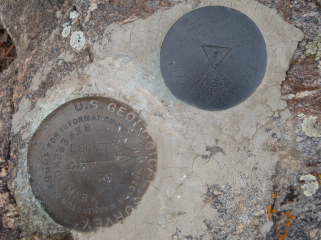
While on the summit, for the whole of 30 seconds I remembered to plug the summit geocache into my GPS. The good thing was I was able to find that without any issue. Nobody had been there since August, I always like finding ones like that. The summit view didn't have much to offer since the snow was flying. The cloud line was probably around 9,500ft today so I decided to keep moving to stay warm.


On my way down the trail I ran into a guy running up the trail with micro spikes on his feet. Man, some people amaze me. It was freezing out and he was running in tights with spikes on his feet. The rest of the trip down the mountain was uneventful. I went down a side trail saying it was a "scenic view" but there was only a view of the town below no mountains.


It was another great day in the Front Range. Hopefully next week I can head up Bergen Peak. This is a bit higher and a longer hike, but I've been out enough I would feel good on a winter day with a thermos of coffee to join me.


Date: 1/24/2012

Starting Elevation: 7,480 Ft.

Summit Elevation: 8,533 Ft.

Distance: 6.26 Miles

Time: 2.5Hrs


Picture 1: Evergreen Mountain mid trail

Picture 2: Route Map

Monday, January 23, 2012

Mount Falcon


This wasn't as much of a summit hike as it was a geocaching adventure. As you may be able to see the starting elevation is higher than the summit elevation. There was a loss in elevation and an adventure in the Mount Falcon Park.

From the west side Mount Falcon parking lot I headed down Parmalee Trail. This trail traverses the southern side of the mountain. I had started out in my new snowshoes thinking this would be a great shoe day, but that's not how it turned out. About 400 yards into the hike I found there was too little snow and strapped the shoes onto my pack and hoofed it in boots.

At the start the trail drops over 500 feet while working the way around the south part of Mt. Falcon. This was a really neat area, the trees and trails were covered in snow. For the most part it was a well packed trail, so I'm assuming this area is heavily used. About a hour into my hike I had a mountain biker come down the trail. I had never seen tires that fat on a bike before, not a chance in hell you would catch me doing that.

After the loss of elevation I made the round about back up to the summit of Mt. Falcon. There was a need little shelter on the summit. I don't think it was a fire lookout, but the views into town were good. After I had a snack I pulled out the GPS and headed to a geocache.

On the way to the cache I ran across the Eagle Eye Shelter. This was a old cabin back in the day and now just has a few tables inside. The view towards the divide from there were pretty amazing. I finally found my geocache and started after a couple more. These took me off course quite a bit, but I had nothing but time to waist today. I ended up hiking all the way to the Summer White House site. This was neat, a lightning bolt around 1915 sometime burned it to the ground. This took me to another cache then a bit further down the trail I got a view of the Red Rock Amphitheater.

I had been out for a few hours now, so I started heading back to the parking lot. There wasn't much elevation gain so it was a nice stroll back. This was a neat area, but I think it's known more for the geocaches then anything else.

Date: 1/9/2012
Starting Elevation: 7,836 feet
Summit Elevation: 7,828 feet
Lost Elevation: 571 feet
Distance: 5.4 miles

Mount Morrison

Mount Morrison is the mountain that is the back drop of the Red Rocks Amphitheater. For this climb I headed to Matthews Winter Park near I-70 and Hwy 93 just out of the town of Morrison.


The start of this hike was from the Matthews Winter Park parking lot. The trails I used to access Mount Morrison were the Village Walk and Red Rocks Trail. These were very hard packed and well used trails. It reminded me of the use of Tablerock Trail in Boise, ID. Switchbacks start up the base of Morrison, on about the 6th turn I got off trail and started up the north ridge.


There were great views along this route. This climb gave me the best views I have had yet. I could clearly see all the way to the divide and down in to the city at the same time. I also got my most challenging climb yet. Mostly class 2, but there was a nice little rock ridge high on the mountain that presented a few good obstacles.


I've heard much about the wildlife in Colorado, but had yet to see much that was very exciting. Today, I finally had something noteworthy. A small heard of deer were about 500 vertical feet below the summit. There was about three or four good sized bucks in the group. I spent a bit of time just observing them and taking a few pictures. After a bit, I let them be and headed up the incline towards the rock ridge.


There is a large false summit you see most of the way. This is where all the radio towers are. My cell didn't work up here, probably because of the interference. After a good trudge I made it across this area and to the true summit. It was a really cold day with a chili wind, so I didn't spend a whole lot of time on top. I took in great views of Pikes Peak to the south and the Evans group to the West all the way to the Flat Irons up north. I wish I could have stayed up there longer, but I like heat.


On the way down I ran across my four legged friends again. Said my hello's and kept walking down the hill. The Red Rocks were beautiful, but there were a lot of people when I made it back to the trail. The lower half definitely had the city feel, which I didn't care much for. I was glad I went, the views made it worth it on the summit.


Date: 11/22/2011

Starting Elevation: 6,320 Ft

Summit Elevation: 7,877 Ft

Distance: 5.5 Miles

Legault Mountain

I did a little research on Summit Post and found another easy mountain to climb that was had a bit higher elevation. Legault Mountain is in the Meyer Ranch Park and stands 9,040 Ft. This was another beautiful area, a bit further from home but within a 45 minute drive.


The route started at the Meyer Ranch parking lot. Starting on the Owl's Perch Trail this connects with the Lodgepole Loop onto the Sunny Aspen Trail to the Old Ski Run Trail then finally onto the the summit ridge of Legault Mountain.


Aspen groves surround much of this area as well as a large amount of Lodgepoles hence the Lodgepole Loop Trail. I saw nobody while in the park area which is very nice for being so close to Denver. The trails were very gradual and covered in snow and ice. Funny story: I finally make it to REI to buy the micro spikes, which I do en route to the park. I arrive at the parking lot and load up my bag. Upon opening the box of spikes, I find there is only one not the pair in the box. Awesome...I went ahead on up the trail and did my best not to "eat it" and made it through without any accidents. On my way home I went to REI and got my other micro spike.

This was a beautiful area and I even ended up taking Kristi snowshoeing here a few months later. Once to the edge of the park there were a lot of private property signs which I had never encountered yet. The funny thing was they were graffiti up with spray paint. I can't imagine hiking all the way up there with spray paint to tag a sign, but then again I'm not a juvenile delinquent.
There was a slight climbers trail leading up the last 300 vertical feet to the summit. I always like a trail! After a nice stair stepping heart pounding gain I made it to the summit. The trees cleared enough to get a nice view of the Front Range. I could clearly see the Mt. Evans group of 14ers which I plan to tackle in the spring.


A great climb up with great rewards of scenery is all I can ask for. On the way back I just re-traced my steps since this wasn't really a loop hike. Now that I have been up to 9,000 Ft hopefully I can start getting up some bigger mountains. But, I will still take my time since I'm doing mostly solo hiking. The great thing is the cell reception is great in the Front Range so I don't need to renew my SPOT Messenger yet.


Date: 11/21/2011

Starting Elevation: 7,880 Ft.

Summit Elevation: 9,040 Ft.

Distance: 5.1 Miles

Plymouth Mountain


This was another starter mountain, but it still counts. Located in the same Deer Creek Canyon Park in Jefferson County, Colorado. Plymouth Mountain has a elevation of 7,270 Ft, so this is a higher summit than nearby neighbor Bill Couch Mountain by a mear 213 Ft. I partnered up with Paul for this hike. Unlike Bill Couch Mountain, there is a trail all the way to the summit of this one.

The route starts in the Deer Creek Canyon parking lot. We headed south on the Plymouth Creek Trail, which was covered in ice thanks to the shade of the canyon. And I didn't make it to REI for the spikes so we had to be mindful of our steps along this part of the trail. After 1.5 miles the trail intersects with Plymouth Mtn Trail. We decided to take this route since it was east facing towards the sun and the trail might be a bit clearer. This trail was pretty sweet, it reminded me of hiking Spencer's Butte over near Eugene, Oregon. The wooded area was nice and the trail was mostly free of ice. This took us directly to summit in a round about traverse of the mountain.


Thanks to Paul, we had some Subway sandwiches for the summit. After a nice break with a great view we headed down the mountain completing the loop of the Plymouth Mtn Trail. At the intersection of the Meadowlark Trail we decided to head that way to get a few more miles in and see some new territory. It was a nice hike on a brisk day.


Date: 11/20/2011

Starting Elevation: 6,080 Ft.

Summit Elevation: 7,270 Ft.

Distance: 6.5 Miles

Partner: Paul

Bill Couch Mountain

This was my first Colorado summit. I know it's not much of a climb by any nature, but it got me out into the foothills. I had recently moved to the Denver area from Idaho, so I figured baby steps were a great idea for someone as out of shape as I was.

Bill Couch Mountain (BCM) can be found in the foothills just west of Littleton, Colorado. I have found the Jefferson County Open Space Parks to be a wonderful place to start with some easy hikes as I get used to the new area. BCM is in the Deer Creek Canyon Park about a 30minute drive from my apartment.

There is a nice set of trails in the park. I started this hike on the Meadowlark Trail which is a hiker only trail. Believe it or not I have ran into mountain bikers on these trails covered with snow and ice. After a nice stroll on the trail it levels out traversing across the west side of BCM. I found what looked to be a good starting point to climb directly to the summit through the snow and rock and headed for the summit. I must say how out of shape I was for this one, because I was almost certain my heart was going to explode. But, this is what I love about hiking and climbing up mountains. This was a short climb on the ridge, maybe took a half hour which always seems much longer.

Once on the summit I had great views of the Denver area. I found a couple geocaches near the summit had a snack, then headed down the ridge back to the trail. After meeting back up with the trail I decided to continue on the loop to where the Meadowlark Trail intersects with the Plymouth Creek Trail. The Plymouth Creek Trail is in a canyon so there was a considerable amount of ice. I found out on this trip the way to go was to wear micro spikes, so I had a trip to REI planned for the way home. After another mile or so I found myself back at the parking lot completing a nice loop hike with a easy summit climb.


Date: 11/8/2011

Starting Elevation: 6,080 Ft.

Summit Elevation: 7,057 Ft.